Unfortunately, your loyal webmaster is stuck in California and won't be able to attend the festivities this weekend because of a conflict with something called work. None too happy about this. ...
We're hoping that somebody will be taking photos and after the carnage clears, will send us shots to display on the site. There are no plans to take down the site. We will continue to update it as time allows and post items of interest involving classmates and developments in Fort Dodge.
In the meantime, have a great, great time and enjoy a cold one on me!
Friday, June 27, 2008
Thursday, June 12, 2008
Highway 30 Flooding Near Boone
This is Highway 30 looking east toward Boone and over the Des Moines River Valley on Wednesday, June 11. Many of you are probably familiar with this road, as it leads toward Ames. Normally you can't even see the river until you cross the bridge.
And this is the view from the other side, looking west toward Ogden. You'll notice old Highway 30 in the upper right-hand corner of the image. As of Thursday, the old highway was still open. It's about 2.5 miles across this valley and it looks like the river is now about a mile wide.
Bruce Stottrup, who sent us these images, also got a ground-level view of the river looking east. Flooding is much, much worse in other parts of the state, with rivers rising to unprecedented levels.
Update: The image below was taken Wednesday, June 18. looking east against toward Ames. Still plenty of standing water.
Monday, June 9, 2008
Brushy Creek
Brushy Creek was long in the planning stages and fraught with delays, but 15 years after the Class of 1978 graduated, the project was completed. Today a 6,000-acre state park — one of Iowa's largest — and a 690-acre man-made lake offer a variety of recreational activities.
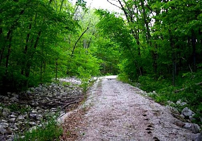
Brushy Creek is located 15 miles southeast of Fort Dodge. Runoff from the spillway trickles into the Des Moines River several miles downstream.There are 53 miles of hiking and horse trails. The beautiful trail pictured here leads to an area below the spillway.
View of the spillway from the bottom of the hiking trail.
There are several boat ramps. This one has steps leading to an elevated area where anglers park vehicles and trailers after launching their vessels.
A view of one of the launching docks. Activities other than boating and fishing include picnicking — with areas and shelters for large gatherings — an equestrian camp ground, swimming, hunting and a shooting range.
Two anglers work the shoreline in late May. There is a 15-inch length minimum for bass and a 40-inch minimum for musky.
Tuesday, June 3, 2008
Back to School
From Senior High on down, a look at what your former schools looks like today, with links where available. Unfortunately, some of the buildings are gone, leaving only a vacant lot. In the case of Pleasant Valley, a church occupies the property.
We begin with a look at Senior High, built in 1958 and still going strong:North Junior High, now Phillips Middle School. It was built in 1922 and was originally the high school:
South Junior High, now Fair Oaks Middle School. The building was constructed in 1931:Arey Elementary. It's now home of the Community School District offices:Badger. What's left is mostly a vacant lot that has become a city park. Some homes are built on fringe of the property:Butler. Actually, this is the new Butler, built on the same location. This sparkling building opened in 2002:
Cooper. Built in 1956, with additions in 1958, 1961 and 1966. One of the newer buildings in the district: Duncombe. Built in 1912, it's the oldest building in the district. An addition was added in 1950. The Senior High used to play its football games on the east field:Feelhaver. This was newest building in the district until Butler opened. Feelhaver opened in 1967:Highland Park. The building remains, but it's no longer a school. Not sure what it is being used for. Anybody know?
Hillcrest. It was built in 1956 with additions in 1961, 1966 and 1971:
Hawley. It's gone. Now it's a city park with a basketball court:
Otho. The school is closed and we're not sure what the building is being used for. Maybe somebody can let us know:Pleasant Valley. As stated, a church now occupies the property:Riverside. It was built in 1957.
St. Edmond. Fort Dodge's Catholic high school has added several buildings in the past few years and a snazzy sign out front:
St. Paul Lutheran. The old church, dedicated in 1886, was destroyed in 1999 in a fire started by an arsonist, but a new place of worship opened in 2003. The school building was dedicated in 1951, enlarged in 1959 and remodeled and dedicated in 1999.
Monday, June 2, 2008
The Parkersburg Tornado
Your humble blogmaster was in Fort Dodge on May 25 when word came that Parkersburg, 80 miles to the east, was hit by a tornado. Hearing the news brought back memories of the tornado that struck Fort Dodge in 1977, our junior year.
But the twister that hit Parkersburg and continued on to New Hartford and Dunkerton was unlike any other. This was a monster storm, rated an F5 — the largest on the Fujita Scale — by the National Weather Service. The twister at times was more than a mile wide and packed winds of 205 miles per hour. It stayed on the ground for 43 miles. Sadly, seven people lost their lives in what was the second-deadliest tornado in Iowa history.
The devastation was unlike anything I've witnessed. Half of Parkersburg (population 2,000) was gone. This little jewel of a city on the Iowa prairie looked like a war zone. Words and pictures don't begin to capture the destruction.
There are so many stories to tell, but the spirit of Iowans in times like this remains unmatched. Every town seemingly had sent help — from rescue and clean-up crews to fire personal. There was Cedar Falls and Charles City (site of Iowa's deadliest tornado in 1968). There was Waverly and Williamsburg. And yes, there was Fort Dodge.
If you're interested in helping in some way, click on this link maintained by radio station KLMJ/KQCR in Hampton. The station's general manager happens to be former Fort Dodger Craig Donnelly and the station has been doing a terrific job updating the recovery efforts in Parkersburg.
The Class of 1978 in 1998
Check it out! Cool video of the 20-year reunion posted over at the Reunion Message Board.
Subscribe to:
Posts (Atom)